
- Start >
- Rivers >
- Waterlevel >
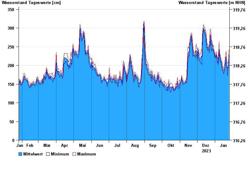
- Isar >
- Plattling >
- Chart of year

Chart of year Plattling / Isar
Waterlevel from 26.01.2023 to 25.01.2024
| Date | Mean value [cm] | Maximum [cm] | Minimum [cm] |
|---|---|---|---|
| 25.01.2024 | 229 | 242 | 209 |
| 24.01.2024 | 201 | 209 | 194 |
| 23.01.2024 | 193 | 208 | 173 |
| 22.01.2024 | 193 | 205 | 176 |
| 21.01.2024 | 205 | 209 | 200 |
| 20.01.2024 | 223 | 238 | 202 |
| 19.01.2024 | 221 | 228 | 208 |
© Bayerisches Landesamt für Umwelt 2024