
- Start >
- Rivers >
- Waterlevel >
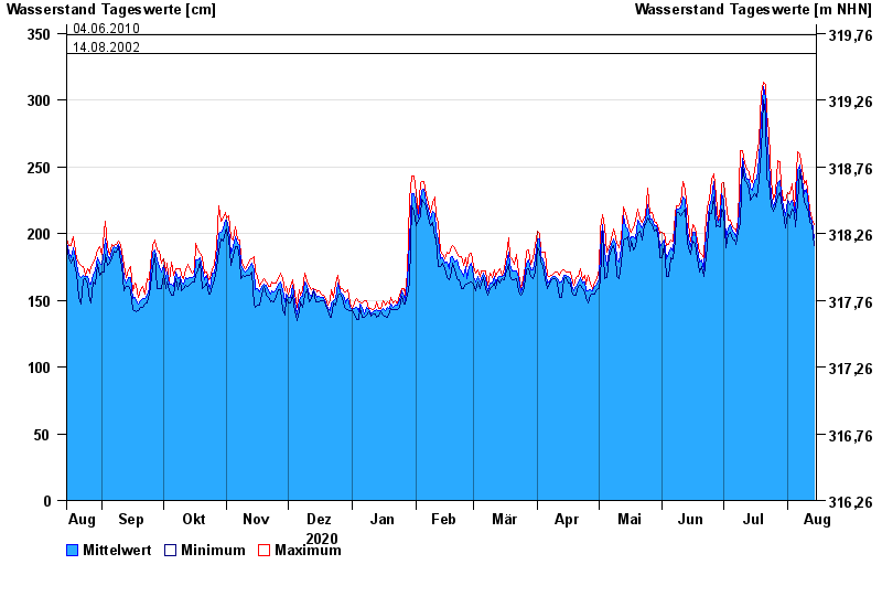
- Isar >
- Plattling >
- Chart of year

Chart of year Plattling / Isar
Waterlevel from 15.08.2020 to 14.08.2021
- 04.06.2013 Wasserstand: 400 cm
- 24.05.1999 Wasserstand: 378 cm
- 25.08.2005 Wasserstand: 374 cm
- 04.06.2010 Wasserstand: 349 cm
- 14.08.2002 Wasserstand: 335 cm
| Date | Mean value [cm] | Maximum [cm] | Minimum [cm] |
|---|---|---|---|
| 14.08.2021 | 197 | 207 | 191 |
| 13.08.2021 | 209 | 211 | 207 |
| 12.08.2021 | 213 | 218 | 208 |
| 11.08.2021 | 221 | 225 | 216 |
| 10.08.2021 | 233 | 240 | 220 |
| 09.08.2021 | 230 | 237 | 223 |
| 08.08.2021 | 241 | 249 | 237 |
© Bayerisches Landesamt für Umwelt 2024