
- Start >
- Rivers >
- Waterlevel >
- Isar >
- Obermühlhausen >
- Chart of month

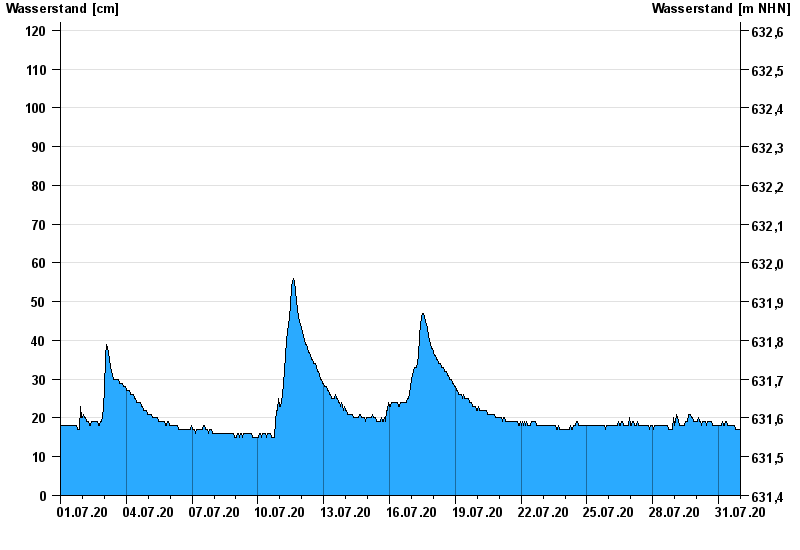
Chart of month Obermühlhausen / Windach
Waterlevel from 01.07.2020 to 31.07.2020
- 21.05.1999 Wasserstand: 183 cm
- 06.08.2000 Wasserstand: 166 cm
- 02.06.2013 Wasserstand: 152 cm
- 17.06.1979 Wasserstand: 152 cm
- 13.04.1994 Wasserstand: 145 cm
| Date | Waterlevel [cm] |
|---|---|
| 01.08.2020 00:45 | 17 |
| 01.08.2020 00:30 | 17 |
| 01.08.2020 00:15 | 17 |
| 01.08.2020 00:00 | 17 |
| 31.07.2020 23:45 | 17 |
| 31.07.2020 23:30 | 17 |
| 31.07.2020 23:15 | 17 |
© Bayerisches Landesamt für Umwelt 2024