
- Start >
- Rivers >
- Waterlevel >
- Isar >
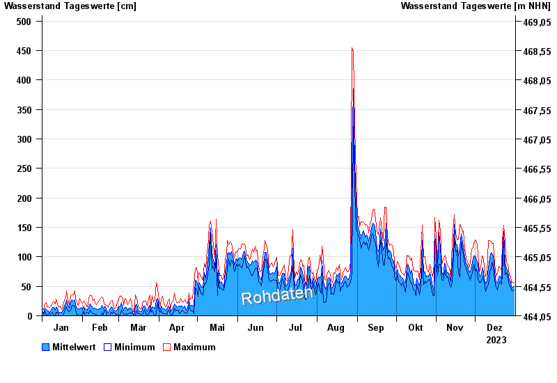
- Oberaudorf >
- Chart of year

Chart of year Oberaudorf / Inn
Waterlevel from 01.01.2023 to 31.12.2023
| Date | Mean value [cm] | Maximum [cm] | Minimum [cm] |
|---|---|---|---|
| 31.12.2023 | 51 | 56 | 44 |
| 30.12.2023 | 48 | 57 | 42 |
| 29.12.2023 | 50 | 55 | 44 |
| 28.12.2023 | 57 | 67 | 49 |
| 27.12.2023 | 62 | 68 | 52 |
| 26.12.2023 | 75 | 87 | 65 |
| 25.12.2023 | 83 | 90 | 73 |
© Bayerisches Landesamt für Umwelt 2025