
- Start >
- Rivers >
- Waterlevel >
- Isar >
- Neumühlschwaig >
- Chart of month

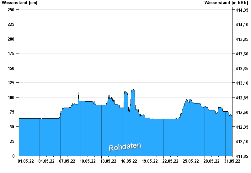
Chart of month Neumühlschwaig / Amper
Waterlevel from 01.05.2022 to 31.05.2022
- 04.06.2013 Wasserstand: 401 cm
- 15.04.1994 Wasserstand: 379 cm
- 19.06.1979 Wasserstand: 370 cm
- 27.05.1999 Wasserstand: 367 cm
- 01.02.1982 Wasserstand: 353 cm
| Date | Waterlevel [cm] |
|---|---|
| 01.06.2022 00:45 | 70 |
| 01.06.2022 00:30 | 69 |
| 01.06.2022 00:15 | 69 |
| 01.06.2022 00:00 | 69 |
| 31.05.2022 23:45 | 69 |
| 31.05.2022 23:30 | 69 |
| 31.05.2022 23:15 | 69 |
© Bayerisches Landesamt für Umwelt 2024