
- Start >
- Rivers >
- Waterlevel >
- Isar >
- München >
- Chart of year

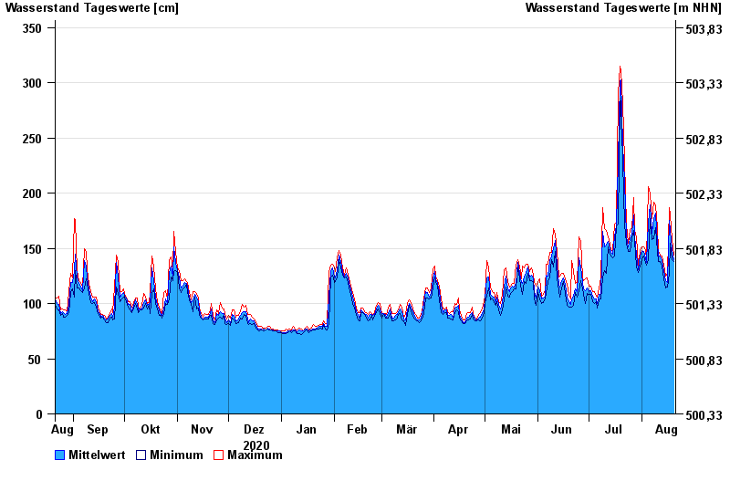
Chart of year München / Isar
Waterlevel from 21.08.2020 to 20.08.2021
- 24.08.2005 Wasserstand: 542 cm
- 22.05.1999 Wasserstand: 469 cm
- 03.06.2013 Wasserstand: 432 cm
- 20.07.1981 Wasserstand: 424 cm
- 18.06.1979 Wasserstand: 424 cm
| Date | Mean value [cm] | Maximum [cm] | Minimum [cm] |
|---|---|---|---|
| 20.08.2021 | 140 | 144 | 138 |
| 19.08.2021 | 149 | 159 | 140 |
| 18.08.2021 | 166 | 180 | 155 |
| 17.08.2021 | 175 | 187 | 127 |
| 16.08.2021 | 119 | 127 | 115 |
| 15.08.2021 | 121 | 125 | 114 |
| 14.08.2021 | 130 | 135 | 122 |
© Bayerisches Landesamt für Umwelt 2024