
- Start >
- Rivers >
- Waterlevel >
- Isar >
- Mühltal >
- Chart of year

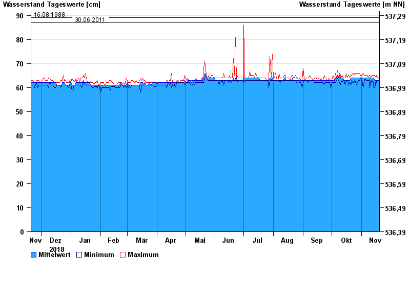
Chart of year Mühltal / Glonn
Waterlevel from 20.11.2018 to 19.11.2019
- 11.08.2002 Wasserstand: 254 cm
- 01.08.2002 Wasserstand: 96 cm
- 09.09.1979 Wasserstand: 94 cm
- 16.08.1988 Wasserstand: 89 cm
- 30.06.2011 Wasserstand: 87 cm
| Date | Mean value [cm] | Maximum [cm] | Minimum [cm] |
|---|---|---|---|
| 19.11.2019 | 63 | 64 | 63 |
| 18.11.2019 | 63 | 64 | 63 |
| 17.11.2019 | 63 | 65 | 62 |
| 16.11.2019 | 63 | 64 | 63 |
| 15.11.2019 | 63 | 65 | 60 |
| 14.11.2019 | 64 | 65 | 60 |
| 13.11.2019 | 64 | 65 | 63 |
© Bayerisches Landesamt für Umwelt 2024