
- Start >
- Rivers >
- Waterlevel >
- Isar >
- Mühldorf >
- Chart of year

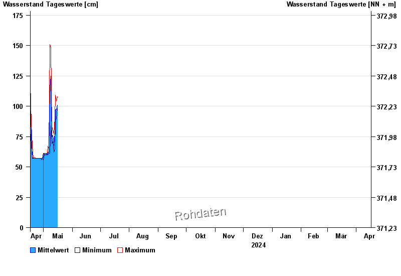
Chart of year Mühldorf / Inn
Waterlevel from 17.04.2024 to 16.04.2025
| Date | Mean value [cm] | Maximum [cm] | Minimum [cm] |
|---|---|---|---|
| 06.06.2024 | 246 | 253 | 241 |
| 05.06.2024 | 273 | 290 | 247 |
| 04.06.2024 | 426 | 536 | 288 |
| 03.06.2024 | 296 | 475 | 202 |
| 02.06.2024 | 262 | 337 | 208 |
| 01.06.2024 | 320 | 390 | 268 |
| 31.05.2024 | 231 | 292 | 175 |
© Bayerisches Landesamt für Umwelt 2024