
- Start >
- Rivers >
- Waterlevel >
- Isar >
- Moosburg >
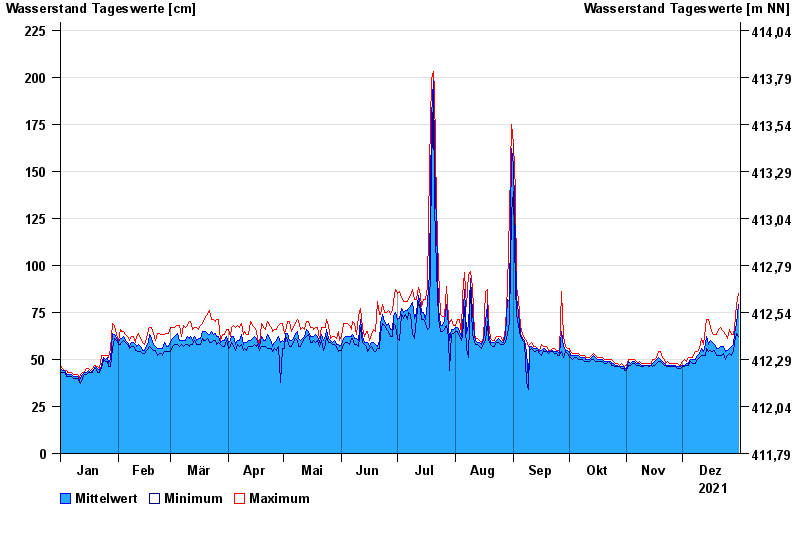
- Chart of year

Chart of year Moosburg / Isar
Waterlevel from 01.01.2021 to 31.12.2021
- 07.10.2009 Wasserstand: 523 cm
- 03.06.2013 Wasserstand: 361 cm
- 04.06.2010 Wasserstand: 314 cm
- 05.08.2020 Wasserstand: 282 cm
- 24.09.2009 Wasserstand: 252 cm
| Date | Mean value [cm] | Maximum [cm] | Minimum [cm] |
|---|---|---|---|
| 31.12.2021 | 79 | 85 | 62 |
| 30.12.2021 | 69 | 79 | 64 |
| 29.12.2021 | 64 | 67 | 59 |
| 28.12.2021 | 58 | 63 | 54 |
| 27.12.2021 | 57 | 63 | 52 |
| 26.12.2021 | 56 | 66 | 53 |
| 25.12.2021 | 55 | 61 | 52 |
© Bayerisches Landesamt für Umwelt 2024