
- Start >
- Rivers >
- Waterlevel >
- Isar >
- Mittenwald >
- Chart of year

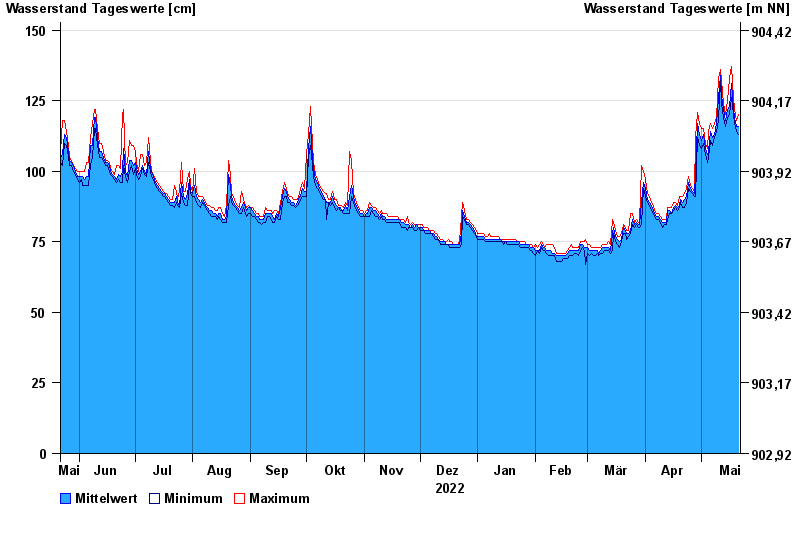
Chart of year Mittenwald / Isar
Waterlevel from 22.05.2022 to 21.05.2023
- 23.08.2005 Wasserstand: 441 cm
- 22.05.1999 Wasserstand: 408 cm
- 01.08.1977 Wasserstand: 380 cm
- 11.07.2005 Wasserstand: 354 cm
- 12.08.2002 Wasserstand: 346 cm
| Date | Mean value [cm] | Maximum [cm] | Minimum [cm] |
|---|---|---|---|
| 21.05.2023 | 116 | 120 | 113 |
| 20.05.2023 | 116 | 118 | 114 |
| 19.05.2023 | 119 | 122 | 117 |
| 18.05.2023 | 122 | 126 | 120 |
| 17.05.2023 | 131 | 137 | 126 |
| 16.05.2023 | 123 | 133 | 120 |
| 15.05.2023 | 122 | 125 | 119 |
© Bayerisches Landesamt für Umwelt 2024