
- Start >
- Rivers >
- Waterlevel >
- Isar >
- Miesbach >
- Chart of total period

Chart of total period Miesbach / Schlierach
Waterlevel from 30.10.1939 to 26.04.2024
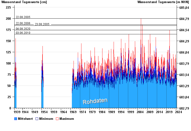
- 22.08.2005 Wasserstand: 200 cm
- 22.06.2006 Wasserstand: 186 cm
- 23.08.2005 Wasserstand: 184 cm
- 04.08.2020 Wasserstand: 174 cm
- 03.06.2010 Wasserstand: 165 cm
| Date | Mean value [cm] | Maximum [cm] | Minimum [cm] |
|---|---|---|---|
| 26.04.2024 | 55 | 56 | 54 |
| 25.04.2024 | 57 | 58 | 55 |
| 24.04.2024 | 56 | 61 | 52 |
| 23.04.2024 | 55 | 57 | 54 |
| 22.04.2024 | 57 | 59 | 55 |
| 21.04.2024 | 58 | 61 | 55 |
| 20.04.2024 | 57 | 60 | 54 |
© Bayerisches Landesamt für Umwelt 2024