
- Start >
- Rivers >
- Waterlevel >
- Isar >
- Miesbach >
- Chart of month

Chart of month Miesbach / Schlierach
Waterlevel from 27.05.2020 to 26.06.2020
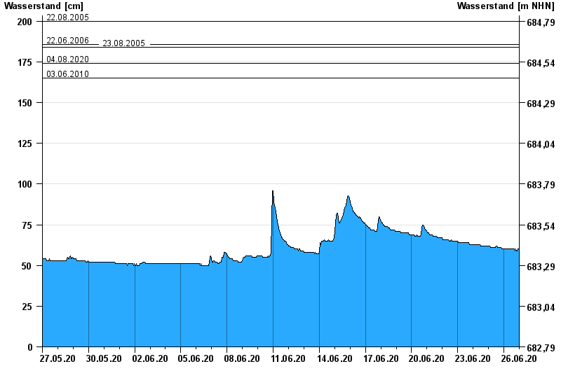
- 22.08.2005 Wasserstand: 200 cm
- 22.06.2006 Wasserstand: 186 cm
- 23.08.2005 Wasserstand: 184 cm
- 04.08.2020 Wasserstand: 174 cm
- 03.06.2010 Wasserstand: 165 cm
| Date | Waterlevel [cm] |
|---|---|
| 27.06.2020 00:45 | 60 |
| 27.06.2020 00:30 | 60 |
| 27.06.2020 00:15 | 60 |
| 27.06.2020 00:00 | 60 |
| 26.06.2020 23:45 | 60 |
| 26.06.2020 23:30 | 60 |
| 26.06.2020 23:15 | 59 |
© Bayerisches Landesamt für Umwelt 2024