
- Start >
- Rivers >
- Waterlevel >
- Isar >
- Mering >
- Chart of year

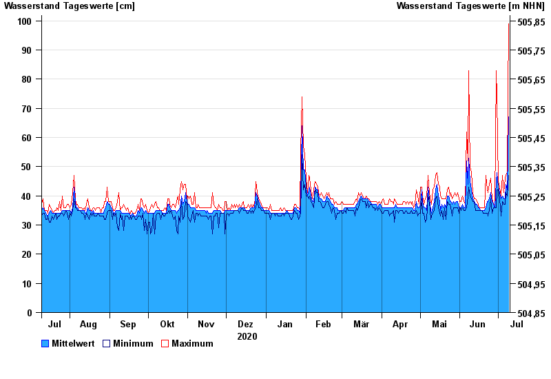
Chart of year Mering / Paar
Waterlevel from 10.07.2020 to 09.07.2021
- 22.05.1999 Wasserstand: 223 cm
- 19.08.1987 Wasserstand: 198 cm
- 12.08.2002 Wasserstand: 197 cm
- 22.09.2000 Wasserstand: 193 cm
- 14.04.1994 Wasserstand: 191 cm
| Date | Mean value [cm] | Maximum [cm] | Minimum [cm] |
|---|---|---|---|
| 09.07.2021 | 67 | 99 | 47 |
| 08.07.2021 | 42 | 48 | 40 |
| 07.07.2021 | 44 | 47 | 41 |
| 06.07.2021 | 39 | 46 | 37 |
| 05.07.2021 | 39 | 41 | 37 |
| 04.07.2021 | 40 | 47 | 38 |
| 03.07.2021 | 39 | 40 | 33 |
© Bayerisches Landesamt für Umwelt 2024