
- Start >
- Rivers >
- Waterlevel >
- Isar >
- Maxkron >
- Chart of month

Chart of month Maxkron / Loisach
Waterlevel from 19.04.2024 to 18.05.2024
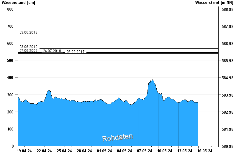
- 03.06.2013 Wasserstand: 653 cm
- 03.06.2010 Wasserstand: 570 cm
- 27.06.2009 Wasserstand: 547 cm
- 24.07.2010 Wasserstand: 545 cm
- 03.09.2017 Wasserstand: 540 cm
| Date | Waterlevel [cm] |
|---|---|
| 19.05.2024 00:45 | 263 |
| 19.05.2024 00:30 | 263 |
| 19.05.2024 00:15 | 263 |
| 19.05.2024 00:00 | 262 |
| 18.05.2024 23:45 | 263 |
| 18.05.2024 23:30 | 263 |
| 18.05.2024 23:15 | 261 |
© Bayerisches Landesamt für Umwelt 2024