
- Start >
- Rivers >
- Waterlevel >
- Isar >
- Langengeisling >
- Chart of year

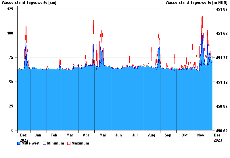
Chart of year Langengeisling / Saubach
Waterlevel from 08.12.2022 to 07.12.2023
- 03.06.2013 Wasserstand: 209 cm
- 02.08.1991 Wasserstand: 180 cm
- 15.02.1990 Wasserstand: 172 cm
- 07.06.1995 Wasserstand: 171 cm
- 31.01.1982 Wasserstand: 167 cm
| Date | Mean value [cm] | Maximum [cm] | Minimum [cm] |
|---|---|---|---|
| 07.12.2023 | 75 | 76 | 71 |
| 06.12.2023 | 72 | 76 | 70 |
| 05.12.2023 | 72 | 75 | 69 |
| 04.12.2023 | 74 | 76 | 72 |
| 03.12.2023 | 76 | 80 | 72 |
| 02.12.2023 | 81 | 88 | 75 |
| 01.12.2023 | 76 | 87 | 68 |
© Bayerisches Landesamt für Umwelt 2024