
- Start >
- Rivers >
- Waterlevel >
- Isar >
- Landshut Birket >
- Chart of year

Chart of year Landshut Birket / Isar
Waterlevel from 29.03.2024 to 28.03.2025
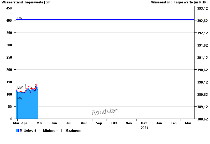
| Date | Mean value [cm] | Maximum [cm] | Minimum [cm] |
|---|---|---|---|
| 06.06.2024 | 291 | 294 | 288 |
| 05.06.2024 | 315 | 331 | 295 |
| 04.06.2024 | 329 | 338 | 322 |
| 03.06.2024 | 342 | 352 | 336 |
| 02.06.2024 | 345 | 354 | 314 |
| 01.06.2024 | 230 | 313 | 165 |
| 31.05.2024 | 150 | 165 | 140 |
© Bayerisches Landesamt für Umwelt 2024