
- Start >
- Rivers >
- Waterlevel >
- Isar >
- Kochel >
- Chart of month

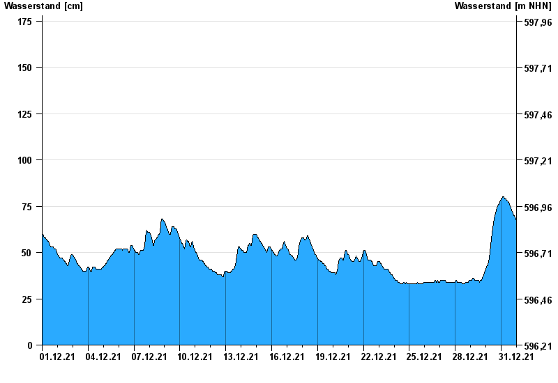
Chart of month Kochel / Loisach
Waterlevel from 01.12.2021 to 31.12.2021
- 24.08.2005 Wasserstand: 454 cm
- 23.05.1999 Wasserstand: 435 cm
- 11.08.1970 Wasserstand: 409 cm
- 21.07.1981 Wasserstand: 399 cm
- 03.06.2013 Wasserstand: 396 cm
| Date | Waterlevel [cm] |
|---|---|
| 31.12.2021 23:45 | 67 |
| 31.12.2021 23:30 | 67 |
| 31.12.2021 23:15 | 67 |
| 31.12.2021 23:00 | 67 |
| 31.12.2021 22:45 | 67 |
| 31.12.2021 22:30 | 68 |
| 31.12.2021 22:15 | 68 |
© Bayerisches Landesamt für Umwelt 2024