
- Start >
- Rivers >
- Waterlevel >
- Isar >
- Kochel >
- Chart of month

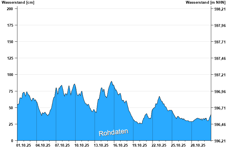
Chart of month Kochel / Loisach
Waterlevel from 01.10.2025 to 30.10.2025
- 24.08.2005 Wasserstand: 456 cm
- 23.05.1999 Wasserstand: 437 cm
- 11.08.1970 Wasserstand: 411 cm
- 21.07.1981 Wasserstand: 401 cm
- 03.06.2013 Wasserstand: 398 cm
| Date | Waterlevel [cm] |
|---|---|
| 30.10.2025 23:45 | 39 |
| 30.10.2025 23:30 | 39 |
| 30.10.2025 23:15 | 39 |
| 30.10.2025 23:00 | 39 |
| 30.10.2025 22:45 | 39 |
| 30.10.2025 22:30 | 38 |
| 30.10.2025 22:15 | 38 |
© Bayerisches Landesamt für Umwelt 2025