
- Start >
- Rivers >
- Waterlevel >
- Isar >
- Inkofen >
- Chart of month

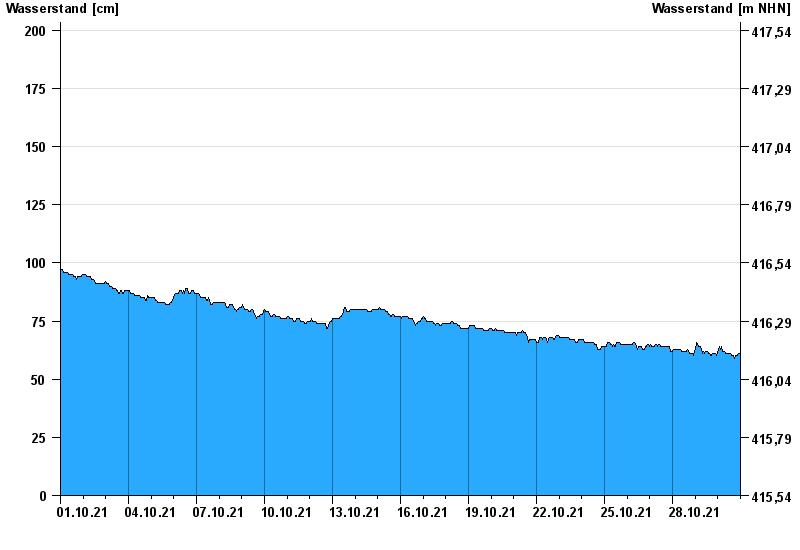
Chart of month Inkofen / Amper
Waterlevel from 01.10.2021 to 30.10.2021
- 15.04.1994 Wasserstand: 366 cm
- 04.06.2013 Wasserstand: 364 cm
- 12.06.1965 Wasserstand: 333 cm
- 26.05.1999 Wasserstand: 315 cm
- 02.06.1965 Wasserstand: 313 cm
| Date | Waterlevel [cm] |
|---|---|
| 31.10.2021 00:45 | 61 |
| 31.10.2021 00:30 | 61 |
| 31.10.2021 00:15 | 61 |
| 31.10.2021 00:00 | 61 |
| 30.10.2021 23:45 | 61 |
| 30.10.2021 23:30 | 61 |
| 30.10.2021 23:15 | 61 |
© Bayerisches Landesamt für Umwelt 2024