
- Start >
- Rivers >
- Waterlevel >
- Isar >
- Haunstetten >
- Chart of year

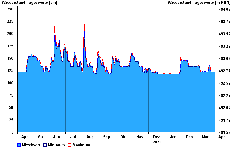
Chart of year Haunstetten / Lech
Waterlevel from 04.04.2020 to 03.04.2021
- 22.05.1999 Wasserstand: 386 cm
- 24.08.2005 Wasserstand: 372 cm
- 14.05.1999 Wasserstand: 317 cm
- 12.08.2002 Wasserstand: 288 cm
- 07.08.2000 Wasserstand: 287 cm
| Date | Mean value [cm] | Maximum [cm] | Minimum [cm] |
|---|---|---|---|
| 03.04.2021 | 122 | 122 | 122 |
| 02.04.2021 | 122 | 122 | 122 |
| 01.04.2021 | 122 | 122 | 121 |
| 31.03.2021 | 122 | 122 | 122 |
| 30.03.2021 | 122 | 122 | 122 |
| 29.03.2021 | 122 | 122 | 121 |
| 28.03.2021 | 122 | 122 | 121 |
© Bayerisches Landesamt für Umwelt 2024