
- Start >
- Rivers >
- Waterlevel >
- Isar >
- Hammer >
- Chart of month

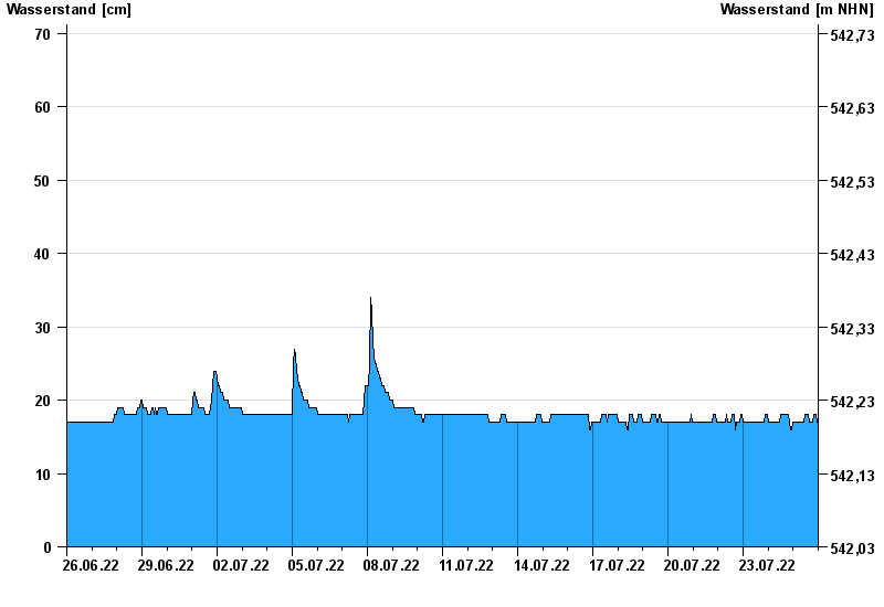
Chart of month Hammer / Oberteisendorfer Ache
Waterlevel from 26.06.2022 to 25.07.2022
- 04.08.2020 Wasserstand: 146 cm
- 12.08.2002 Wasserstand: 132 cm
- 11.06.1971 Wasserstand: 126 cm
- 26.06.1995 Wasserstand: 113 cm
- 08.08.1991 Wasserstand: 112 cm
| Date | Waterlevel [cm] |
|---|---|
| 26.07.2022 00:45 | 18 |
| 26.07.2022 00:30 | 17 |
| 26.07.2022 00:15 | 17 |
| 26.07.2022 00:00 | 17 |
| 25.07.2022 23:45 | 17 |
| 25.07.2022 23:30 | 17 |
| 25.07.2022 23:15 | 17 |
© Bayerisches Landesamt für Umwelt 2024