
- Start >
- Rivers >
- Waterlevel >
- Isar >
- Grafrath >
- Current values

Current values Grafrath / Amper
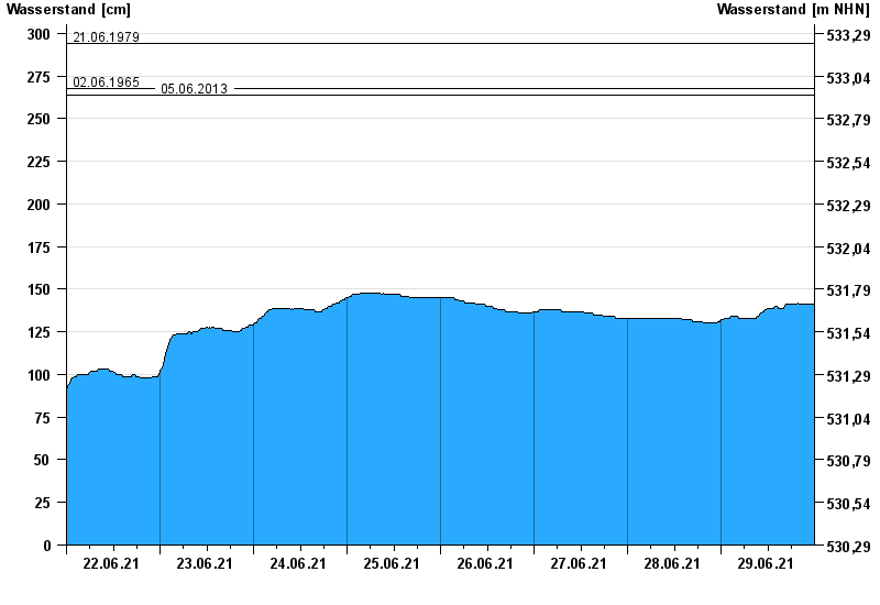
Waterlevel from 22.06.2021 to 29.06.2021
- 24.05.1999 Wasserstand: 378 cm
- 12.06.1965 Wasserstand: 346 cm
- 21.06.1979 Wasserstand: 294 cm
- 02.06.1965 Wasserstand: 268 cm
- 05.06.2013 Wasserstand: 264 cm
| Date | Waterlevel [cm] |
|---|---|
| 30.06.2021 00:45 | 141 |
| 30.06.2021 00:30 | 141 |
| 30.06.2021 00:15 | 141 |
| 30.06.2021 00:00 | 141 |
| 29.06.2021 23:45 | 141 |
| 29.06.2021 23:30 | 141 |
| 29.06.2021 23:15 | 141 |
© Bayerisches Landesamt für Umwelt 2024