
- Start >
- Rivers >
- Waterlevel >
- Isar >
- Fürstenfeldbruck >
- Chart of month

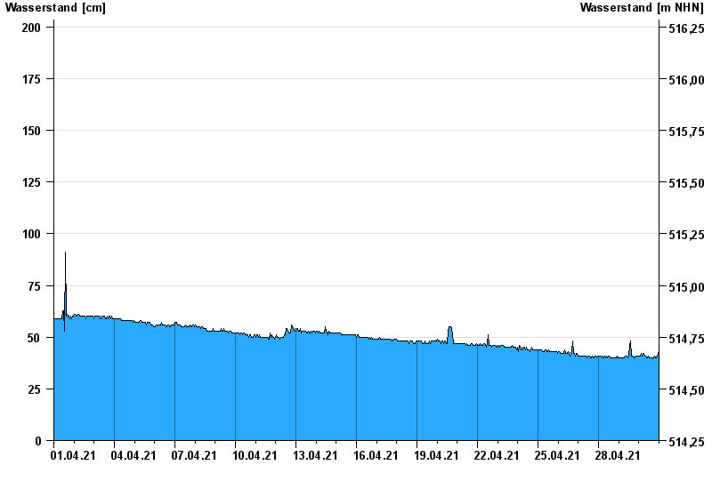
Chart of month Fürstenfeldbruck / Amper
Waterlevel from 01.04.2021 to 30.04.2021
- 03.06.1940 Wasserstand: 257 cm
- 24.05.1999 Wasserstand: 254 cm
- 12.06.1965 Wasserstand: 253 cm
- 13.07.1954 Wasserstand: 223 cm
- 18.06.1910 Wasserstand: 212 cm
| Date | Waterlevel [cm] |
|---|---|
| 01.05.2021 00:45 | 42 |
| 01.05.2021 00:30 | 42 |
| 01.05.2021 00:15 | 43 |
| 01.05.2021 00:00 | 43 |
| 30.04.2021 23:45 | 43 |
| 30.04.2021 23:30 | 43 |
| 30.04.2021 23:15 | 42 |
© Bayerisches Landesamt für Umwelt 2024