
- Start >
- Rivers >
- Waterlevel >
- Isar >
- Dürrach >
- Chart of month

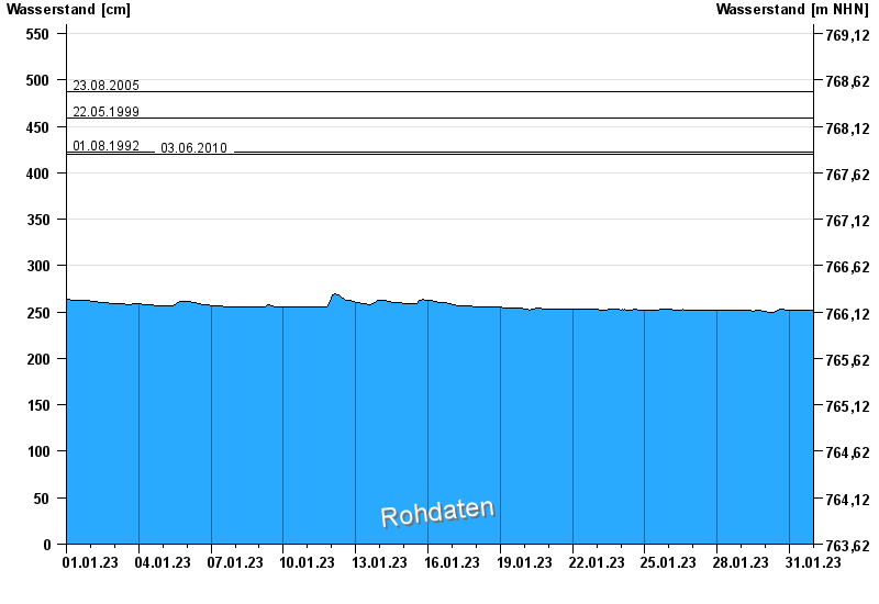
Chart of month Dürrach / Dürrach
Waterlevel from 01.01.2023 to 31.01.2023
Beeinflussung
Wasserstand durch starke Aufkiesung beeinflusst, der Abfluss ist ungültig
- 01.08.1977 Wasserstand: 599 cm
- 23.08.2005 Wasserstand: 487 cm
- 22.05.1999 Wasserstand: 459 cm
- 01.08.1992 Wasserstand: 422 cm
- 03.06.2010 Wasserstand: 420 cm
| Date | Waterlevel [cm] |
|---|---|
| 31.01.2023 23:45 | 252 |
| 31.01.2023 23:30 | 252 |
| 31.01.2023 23:15 | 252 |
| 31.01.2023 23:00 | 252 |
| 31.01.2023 22:45 | 252 |
| 31.01.2023 22:30 | 252 |
| 31.01.2023 22:15 | 252 |
© Bayerisches Landesamt für Umwelt 2024