
- Start >
- Rivers >
- Waterlevel >
- Isar >
- Dietelskirchen >
- Chart of year

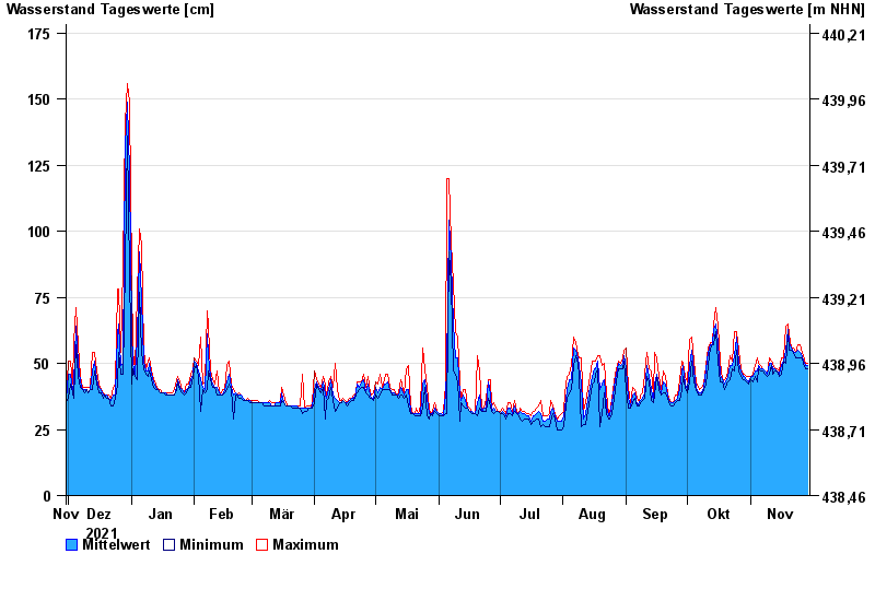
Chart of year Dietelskirchen / Kleine Vils
Waterlevel from 30.11.2021 to 29.11.2022
- 03.08.1991 Wasserstand: 229 cm
- 02.06.2013 Wasserstand: 217 cm
- 02.06.1995 Wasserstand: 209 cm
- 31.01.1982 Wasserstand: 208 cm
- 01.02.1985 Wasserstand: 203 cm
| Date | Mean value [cm] | Maximum [cm] | Minimum [cm] |
|---|---|---|---|
| 29.11.2022 | 49 | 50 | 48 |
| 28.11.2022 | 49 | 50 | 48 |
| 27.11.2022 | 51 | 53 | 50 |
| 26.11.2022 | 53 | 54 | 52 |
| 25.11.2022 | 54 | 57 | 52 |
| 24.11.2022 | 55 | 57 | 52 |
| 23.11.2022 | 54 | 54 | 52 |
© Bayerisches Landesamt für Umwelt 2024