
- Start >
- Rivers >
- Waterlevel >
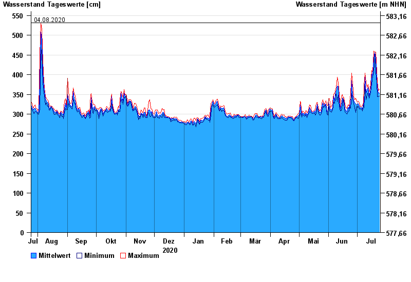
- Isar >
- Beuerberg >
- Chart of year

Chart of year Beuerberg / Loisach
Waterlevel from 25.07.2020 to 24.07.2021
- 24.05.1999 Wasserstand: 572 cm
- 23.08.2005 Wasserstand: 564 cm
- 03.06.2013 Wasserstand: 556 cm
- 18.06.1979 Wasserstand: 556 cm
- 04.08.2020 Wasserstand: 532 cm
| Date | Mean value [cm] | Maximum [cm] | Minimum [cm] |
|---|---|---|---|
| 24.07.2021 | 354 | 362 | 345 |
| 23.07.2021 | 353 | 360 | 344 |
| 22.07.2021 | 368 | 381 | 344 |
| 21.07.2021 | 389 | 405 | 380 |
| 20.07.2021 | 442 | 457 | 405 |
| 19.07.2021 | 456 | 457 | 454 |
| 18.07.2021 | 441 | 460 | 405 |
© Bayerisches Landesamt für Umwelt 2024