
- Start >
- Rivers >
- Waterlevel >
- Isar >
- Beuerberg >
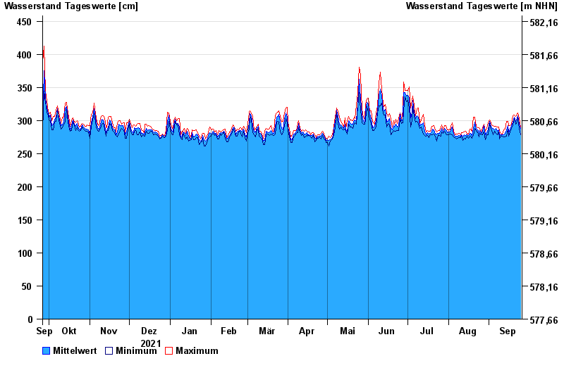
- Chart of year

Chart of year Beuerberg / Loisach
Waterlevel from 26.09.2021 to 25.09.2022
- 24.05.1999 Wasserstand: 572 cm
- 23.08.2005 Wasserstand: 564 cm
- 03.06.2013 Wasserstand: 556 cm
- 18.06.1979 Wasserstand: 556 cm
- 04.08.2020 Wasserstand: 532 cm
| Date | Mean value [cm] | Maximum [cm] | Minimum [cm] |
|---|---|---|---|
| 25.09.2022 | 287 | 289 | 278 |
| 24.09.2022 | 296 | 304 | 287 |
| 23.09.2022 | 307 | 311 | 304 |
| 22.09.2022 | 303 | 309 | 298 |
| 21.09.2022 | 299 | 306 | 295 |
| 20.09.2022 | 305 | 308 | 303 |
| 19.09.2022 | 298 | 307 | 293 |
© Bayerisches Landesamt für Umwelt 2024