
- Start >
- Rivers >
- Waterlevel >
- Isar >
- Beuerberg >
- Chart of year

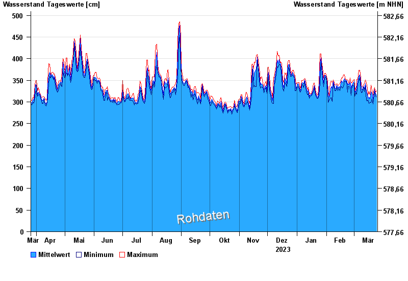
Chart of year Beuerberg / Loisach
Waterlevel from 26.03.2023 to 25.03.2024
- 24.05.1999 Wasserstand: 572 cm
- 23.08.2005 Wasserstand: 564 cm
- 03.06.2013 Wasserstand: 556 cm
- 18.06.1979 Wasserstand: 556 cm
- 04.08.2020 Wasserstand: 532 cm
| Date | Mean value [cm] | Maximum [cm] | Minimum [cm] |
|---|---|---|---|
| 25.03.2024 | 316 | 326 | 312 |
| 24.03.2024 | 318 | 323 | 313 |
| 23.03.2024 | 328 | 333 | 323 |
| 22.03.2024 | 322 | 329 | 316 |
| 21.03.2024 | 307 | 316 | 295 |
| 20.03.2024 | 320 | 326 | 307 |
| 19.03.2024 | 324 | 339 | 299 |
© Bayerisches Landesamt für Umwelt 2024