
- Start >
- Rivers >
- Waterlevel >
- Isar >
- Beuerberg >
- Current values

Current values Beuerberg / Loisach
Waterlevel from 06.02.2023 to 13.02.2023
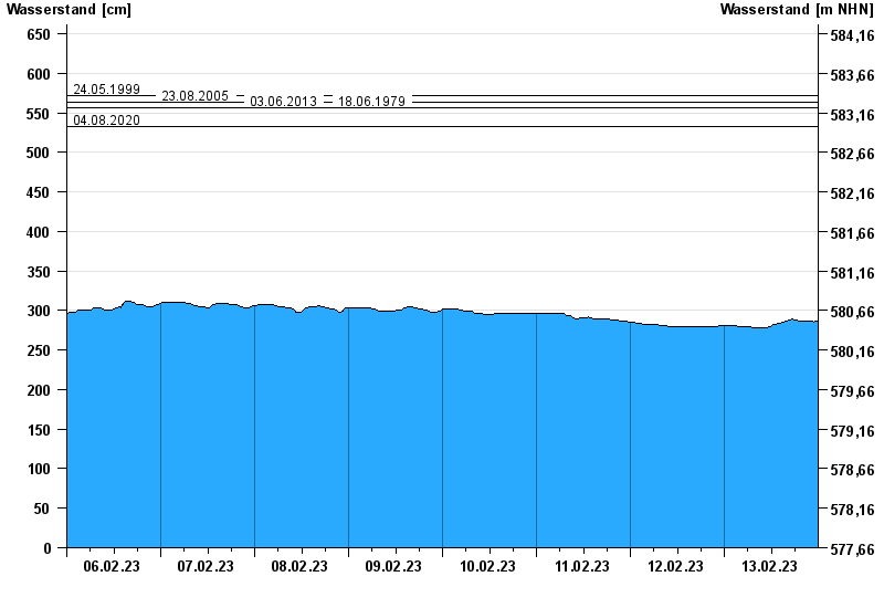
- 24.05.1999 Wasserstand: 572 cm
- 23.08.2005 Wasserstand: 564 cm
- 03.06.2013 Wasserstand: 556 cm
- 18.06.1979 Wasserstand: 556 cm
- 04.08.2020 Wasserstand: 532 cm
| Date | Waterlevel [cm] |
|---|---|
| 13.02.2023 23:45 | 287 |
| 13.02.2023 23:30 | 286 |
| 13.02.2023 23:15 | 286 |
| 13.02.2023 23:00 | 286 |
| 13.02.2023 22:45 | 285 |
| 13.02.2023 22:30 | 286 |
| 13.02.2023 22:15 | 286 |
© Bayerisches Landesamt für Umwelt 2024