
- Start >
- Rivers >
- Waterlevel >
- Isar >
- Baierbrunn >
- Current values

Current values Baierbrunn / Isar
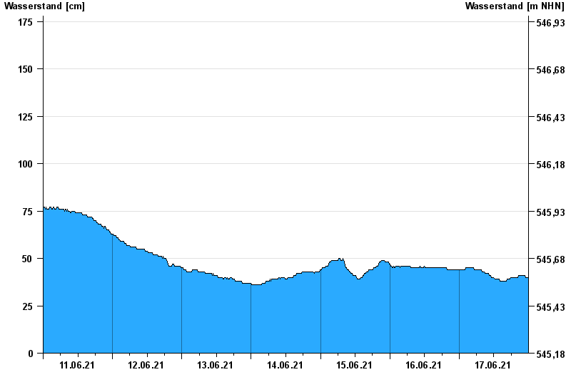
Waterlevel from 11.06.2021 to 17.06.2021
- 24.08.2005 Wasserstand: 361 cm
- 22.05.1999 Wasserstand: 331 cm
- 03.06.2013 Wasserstand: 307 cm
- 18.06.1979 Wasserstand: 291 cm
- 20.07.1981 Wasserstand: 285 cm
| Date | Waterlevel [cm] |
|---|---|
| 18.06.2021 00:45 | 39 |
| 18.06.2021 00:30 | 39 |
| 18.06.2021 00:15 | 40 |
| 18.06.2021 00:00 | 40 |
| 17.06.2021 23:45 | 40 |
| 17.06.2021 23:30 | 40 |
| 17.06.2021 23:15 | 40 |
© Bayerisches Landesamt für Umwelt 2024