
- Start >
- Rivers >
- Waterlevel >
- Isar >
- Bad Trißl >
- Chart of month

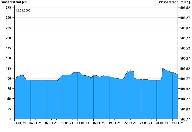
Chart of month Bad Trißl / Auerbach
Waterlevel from 01.01.2021 to 31.01.2021
- 20.02.1999 Wasserstand: 337 cm
- 30.01.2000 Wasserstand: 298 cm
- 21.05.1999 Wasserstand: 279 cm
- 22.12.1991 Wasserstand: 276 cm
- 12.08.2002 Wasserstand: 264 cm
| Date | Waterlevel [cm] |
|---|---|
| 31.01.2021 23:45 | 110 |
| 31.01.2021 23:30 | 110 |
| 31.01.2021 23:15 | 110 |
| 31.01.2021 23:00 | 110 |
| 31.01.2021 22:45 | 110 |
| 31.01.2021 22:30 | 110 |
| 31.01.2021 22:15 | 110 |
© Bayerisches Landesamt für Umwelt 2024