
- Start >
- Rivers >
- Waterlevel >
- Isar >
- Bad Aibling >
- Chart of year

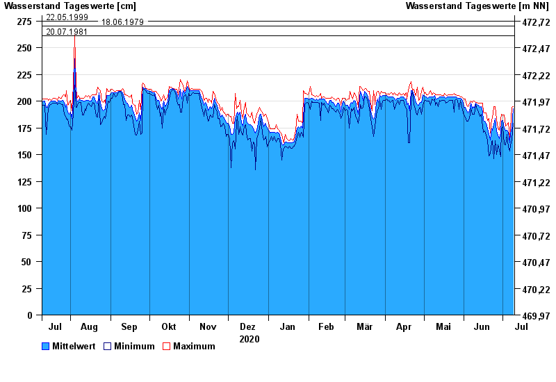
Chart of year Bad Aibling / Triftbach linker Mühlkanal
Waterlevel from 10.07.2020 to 09.07.2021
- 02.06.2013 Wasserstand: 332 cm
- 10.08.1970 Wasserstand: 280 cm
- 22.05.1999 Wasserstand: 275 cm
- 18.06.1979 Wasserstand: 270 cm
- 20.07.1981 Wasserstand: 261 cm
| Date | Mean value [cm] | Maximum [cm] | Minimum [cm] |
|---|---|---|---|
| 09.07.2021 | 193 | 195 | 179 |
| 08.07.2021 | 175 | 194 | 164 |
| 07.07.2021 | 170 | 175 | 159 |
| 06.07.2021 | 161 | 165 | 153 |
| 05.07.2021 | 170 | 180 | 157 |
| 04.07.2021 | 173 | 178 | 169 |
| 03.07.2021 | 172 | 177 | 159 |
© Bayerisches Landesamt für Umwelt 2024