
- Start >
- Rivers >
- Waterlevel >
- Isar >
- Bad Aibling >
- Chart of month

Chart of month Bad Aibling / Triftbach linker Mühlkanal
Waterlevel from 19.05.2021 to 18.06.2021
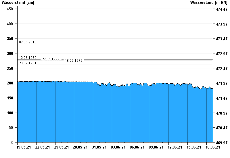
- 02.06.2013 Wasserstand: 332 cm
- 10.08.1970 Wasserstand: 280 cm
- 22.05.1999 Wasserstand: 275 cm
- 18.06.1979 Wasserstand: 270 cm
- 20.07.1981 Wasserstand: 261 cm
| Date | Waterlevel [cm] |
|---|---|
| 19.06.2021 00:45 | 175 |
| 19.06.2021 00:30 | 177 |
| 19.06.2021 00:15 | 180 |
| 19.06.2021 00:00 | 179 |
| 18.06.2021 23:45 | 176 |
| 18.06.2021 23:30 | 171 |
| 18.06.2021 23:15 | 172 |
© Bayerisches Landesamt für Umwelt 2024