
- Start >
- Rivers >
- Waterlevel >
- Isar >
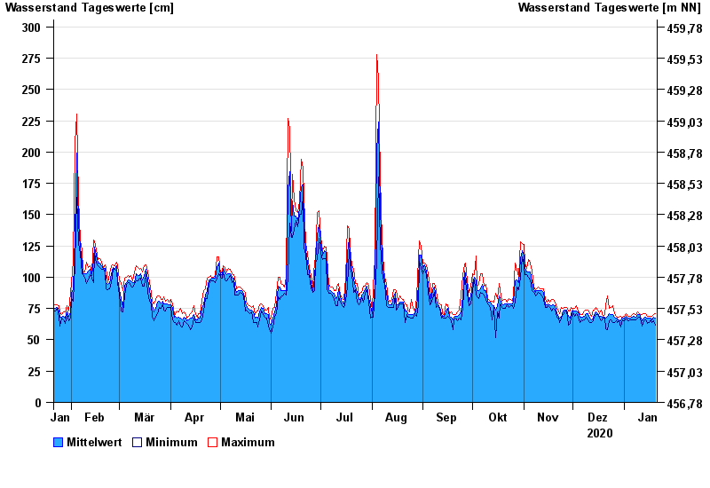
- Augsburg u. d. Wertachmündung >
- Chart of year

Chart of year Augsburg u. d. Wertachmündung / Lech
Waterlevel from 21.01.2020 to 20.01.2021
note
Abflussermittlung bei Hochwasser durch Geschiebeverlagerung beeinflusst
- 24.08.2005 Wasserstand: 559 cm
- 11.08.1970 Wasserstand: 556 cm
- 22.05.1999 Wasserstand: 553 cm
- 24.07.1966 Wasserstand: 482 cm
- 11.06.1965 Wasserstand: 475 cm
| Date | Mean value [cm] | Maximum [cm] | Minimum [cm] |
|---|---|---|---|
| 20.01.2021 | 67 | 71 | 62 |
| 19.01.2021 | 68 | 70 | 65 |
| 18.01.2021 | 66 | 69 | 64 |
| 17.01.2021 | 67 | 69 | 66 |
| 16.01.2021 | 67 | 69 | 64 |
| 15.01.2021 | 67 | 69 | 63 |
| 14.01.2021 | 68 | 71 | 66 |
© Bayerisches Landesamt für Umwelt 2024