
- Start >
- Rivers >
- Waterlevel >
- Isar >
- Augsburg Oberhausen >
- Chart of month

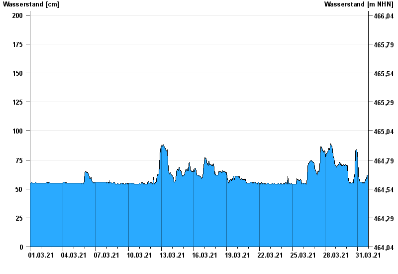
Chart of month Augsburg Oberhausen / Wertach
Waterlevel from 01.03.2021 to 31.03.2021
Hinweis
Ausgabe von Abflusswerten erst bei Hochwasser ab W = 210 cm
- 22.05.1999 Wasserstand: 512 cm
- 12.08.2002 Wasserstand: 455 cm
- 23.08.2005 Wasserstand: 442 cm
- 07.08.2000 Wasserstand: 430 cm
- 22.09.2000 Wasserstand: 410 cm
| Date | Waterlevel [cm] |
|---|---|
| 01.04.2021 00:45 | 55 |
| 01.04.2021 00:30 | 55 |
| 01.04.2021 00:15 | 55 |
| 01.04.2021 00:00 | 55 |
| 31.03.2021 23:45 | 56 |
| 31.03.2021 23:30 | 56 |
| 31.03.2021 23:15 | 58 |
© Bayerisches Landesamt für Umwelt 2024