
- Start >
- Rivers >
- Waterlevel >
- Isar >
- Aßling >
- Chart of year

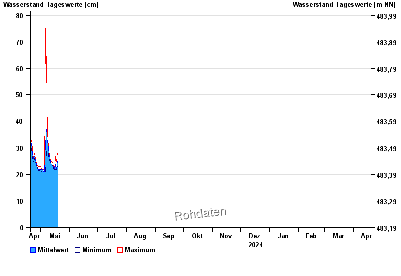
Chart of year Aßling / Attel
Waterlevel from 20.04.2024 to 19.04.2025
- 02.08.1991 Wasserstand: 188 cm
- 04.08.2020 Wasserstand: 183 cm
- 02.06.2013 Wasserstand: 174 cm
- 21.05.1999 Wasserstand: 169 cm
- 15.02.1990 Wasserstand: 155 cm
| Date | Mean value [cm] | Maximum [cm] | Minimum [cm] |
|---|---|---|---|
| 07.06.2024 | 34 | 35 | 34 |
| 06.06.2024 | 36 | 38 | 35 |
| 05.06.2024 | 41 | 44 | 38 |
| 04.06.2024 | 49 | 55 | 44 |
| 03.06.2024 | 61 | 66 | 55 |
| 02.06.2024 | 88 | 126 | 66 |
| 01.06.2024 | 109 | 134 | 60 |
© Bayerisches Landesamt für Umwelt 2024