
- Start >
- Rivers >
- Waterlevel >
- Isar >
- Anger >
- Current values

Current values Anger / Attel
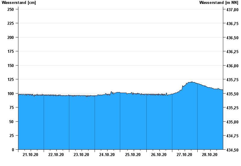
Waterlevel from 21.10.2020 to 28.10.2020
- 02.08.1991 Wasserstand: 293 cm
- 05.08.2020 Wasserstand: 262 cm
- 03.06.2013 Wasserstand: 262 cm
- 18.06.1979 Wasserstand: 258 cm
- 22.05.1999 Wasserstand: 252 cm
| Date | Waterlevel [cm] |
|---|---|
| 28.10.2020 23:45 | 106 |
| 28.10.2020 23:30 | 107 |
| 28.10.2020 23:15 | 107 |
| 28.10.2020 23:00 | 106 |
| 28.10.2020 22:45 | 106 |
| 28.10.2020 22:30 | 107 |
| 28.10.2020 22:15 | 107 |
© Bayerisches Landesamt für Umwelt 2024