
- Start >
- Rivers >
- Waterlevel >
- Isar >
- Ampermoching >
- Chart of year

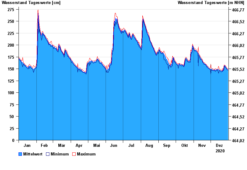
Chart of year Ampermoching / Amper
Waterlevel from 01.01.2020 to 31.12.2020
- 25.05.1999 Wasserstand: 378 cm
- 03.06.2013 Wasserstand: 355 cm
- 23.08.2005 Wasserstand: 336 cm
- 13.04.1994 Wasserstand: 336 cm
- 03.06.2010 Wasserstand: 325 cm
| Date | Mean value [cm] | Maximum [cm] | Minimum [cm] |
|---|---|---|---|
| 31.12.2020 | 148 | 150 | 147 |
| 30.12.2020 | 149 | 151 | 148 |
| 29.12.2020 | 151 | 152 | 149 |
| 28.12.2020 | 151 | 153 | 150 |
| 27.12.2020 | 153 | 155 | 152 |
| 26.12.2020 | 155 | 157 | 154 |
| 25.12.2020 | 157 | 158 | 156 |
© Bayerisches Landesamt für Umwelt 2024