
- Start >
- Rivers >
- Waterlevel >
- Isar >
- Aham >
- Current values

Current values Aham / Vils
Waterlevel from 17.11.2023 to 24.11.2023
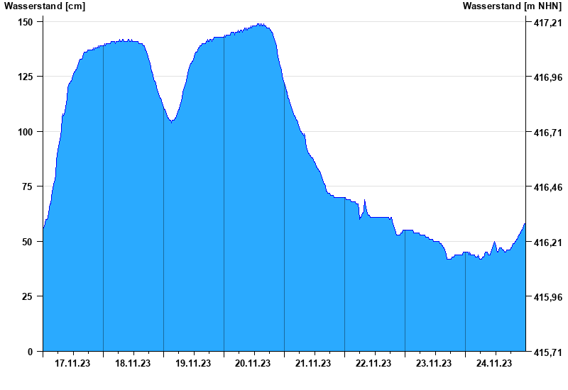
- Hochwassergefahrenfläche HQ100 220 cm
| Date | Waterlevel [cm] |
|---|---|
| 24.11.2023 23:45 | 58 |
| 24.11.2023 23:30 | 58 |
| 24.11.2023 23:15 | 57 |
| 24.11.2023 23:00 | 56 |
| 24.11.2023 22:45 | 56 |
| 24.11.2023 22:30 | 55 |
| 24.11.2023 22:15 | 55 |
© Bayerisches Landesamt für Umwelt 2025