
- Start >
- Rivers >
- Waterlevel >
- Inn >
- Weg >
- Chart of month

Chart of month Weg / Isen
Waterlevel from 01.08.2020 to 31.08.2020
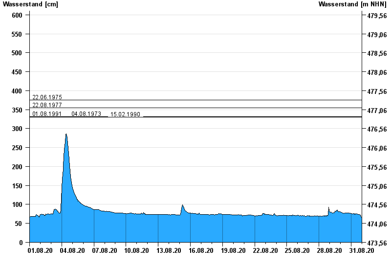
- 22.06.1975 Wasserstand: 375 cm
- 22.08.1977 Wasserstand: 355 cm
- 01.08.1991 Wasserstand: 332 cm
- 04.08.1973 Wasserstand: 332 cm
- 15.02.1990 Wasserstand: 330 cm
| Date | Waterlevel [cm] |
|---|---|
| 01.09.2020 00:45 | 69 |
| 01.09.2020 00:30 | 68 |
| 01.09.2020 00:15 | 67 |
| 01.09.2020 00:00 | 67 |
| 31.08.2020 23:45 | 67 |
| 31.08.2020 23:30 | 67 |
| 31.08.2020 23:15 | 66 |
© Bayerisches Landesamt für Umwelt 2024