
- Start >
- Rivers >
- Waterlevel >
- Inn >
- Waging >
- Chart of month

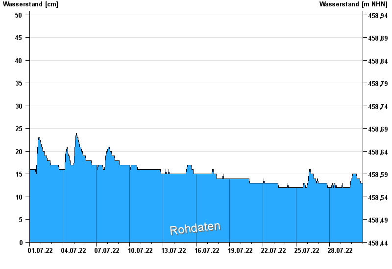
Chart of month Waging / Höllenbach
Waterlevel from 01.07.2022 to 30.07.2022
note
Datenabruf nur 07:00, 15:00 und 23:00 MEZ
- 31.05.1995 Wasserstand: 176 cm
- 26.06.1995 Wasserstand: 172 cm
- 07.07.1983 Wasserstand: 159 cm
- 01.06.2013 Wasserstand: 144 cm
- 12.08.2002 Wasserstand: 142 cm
| Date | Waterlevel [cm] |
|---|---|
| 31.07.2022 00:45 | 13 |
| 31.07.2022 00:30 | 13 |
| 31.07.2022 00:15 | 13 |
| 31.07.2022 00:00 | 13 |
| 30.07.2022 23:45 | 13 |
| 30.07.2022 23:30 | 13 |
| 30.07.2022 23:15 | 13 |
© Bayerisches Landesamt für Umwelt 2024