
- Start >
- Rivers >
- Waterlevel >
- Inn >
- Sylvenstein >
- Chart of year

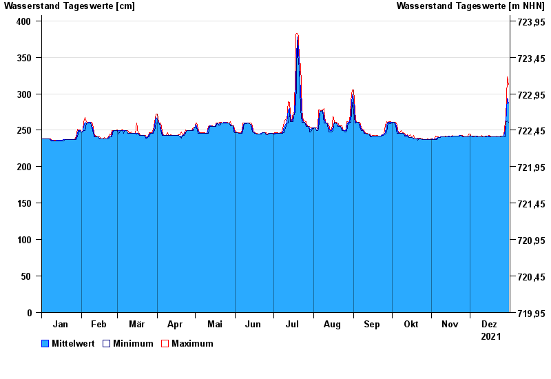
Chart of year Sylvenstein / Isar
Waterlevel from 01.01.2021 to 31.12.2021
- 04.07.1961 Wasserstand: 466 cm
- 24.05.1999 Wasserstand: 456 cm
- 23.08.2005 Wasserstand: 452 cm
- 21.07.1981 Wasserstand: 434 cm
- 11.06.1965 Wasserstand: 408 cm
| Date | Mean value [cm] | Maximum [cm] | Minimum [cm] |
|---|---|---|---|
| 31.12.2021 | 287 | 313 | 261 |
| 30.12.2021 | 294 | 323 | 263 |
| 29.12.2021 | 261 | 266 | 261 |
| 28.12.2021 | 250 | 261 | 241 |
| 27.12.2021 | 242 | 242 | 242 |
| 26.12.2021 | 242 | 242 | 242 |
| 25.12.2021 | 241 | 242 | 241 |
© Bayerisches Landesamt für Umwelt 2024