
- Start >
- Rivers >
- Waterlevel >
- Inn >
- Sylvenstein >
- Chart of month

Chart of month Sylvenstein / Isar
Waterlevel from 26.09.2021 to 25.10.2021
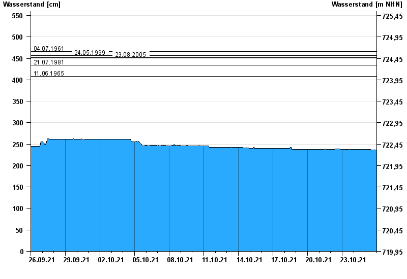
- 04.07.1961 Wasserstand: 466 cm
- 24.05.1999 Wasserstand: 456 cm
- 23.08.2005 Wasserstand: 452 cm
- 21.07.1981 Wasserstand: 434 cm
- 11.06.1965 Wasserstand: 408 cm
| Date | Waterlevel [cm] |
|---|---|
| 26.10.2021 00:45 | 237 |
| 26.10.2021 00:30 | 237 |
| 26.10.2021 00:15 | 237 |
| 26.10.2021 00:00 | 237 |
| 25.10.2021 23:45 | 237 |
| 25.10.2021 23:30 | 237 |
| 25.10.2021 23:15 | 237 |
© Bayerisches Landesamt für Umwelt 2024