
- Start >
- Rivers >
- Waterlevel >
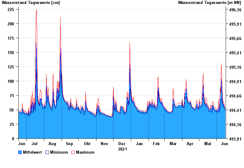
- Inn >
- Stein bei Altenmarkt >
- Chart of year

Chart of year Stein bei Altenmarkt / Traun
Waterlevel from 17.06.2021 to 16.06.2022
- 12.08.2002 Wasserstand: 367 cm
- 02.06.2013 Wasserstand: 347 cm
- 26.06.1995 Wasserstand: 330 cm
- 01.08.1977 Wasserstand: 329 cm
- 20.07.1981 Wasserstand: 328 cm
| Date | Mean value [cm] | Maximum [cm] | Minimum [cm] |
|---|---|---|---|
| 16.06.2022 | 52 | 53 | 48 |
| 15.06.2022 | 53 | 55 | 51 |
| 14.06.2022 | 57 | 61 | 54 |
| 13.06.2022 | 60 | 64 | 56 |
| 12.06.2022 | 59 | 62 | 55 |
| 11.06.2022 | 66 | 72 | 62 |
| 10.06.2022 | 85 | 106 | 72 |
© Bayerisches Landesamt für Umwelt 2024