
- Start >
- Rivers >
- Waterlevel >
- Inn >
- Staufeneck >
- Chart of year

Chart of year Staufeneck / Saalach
Waterlevel from 17.10.2022 to 16.10.2023
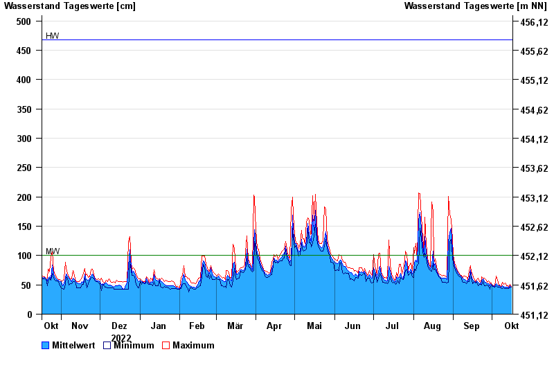
| Date | Mean value [cm] | Maximum [cm] | Minimum [cm] |
|---|---|---|---|
| 16.10.2023 | 46 | 47 | 46 |
| 15.10.2023 | 48 | 51 | 45 |
| 14.10.2023 | 45 | 46 | 44 |
| 13.10.2023 | 46 | 48 | 44 |
| 12.10.2023 | 46 | 49 | 44 |
| 11.10.2023 | 46 | 53 | 44 |
| 10.10.2023 | 47 | 51 | 45 |
© Bayerisches Landesamt für Umwelt 2024