
- Start >
- Rivers >
- Waterlevel >
- Inn >
- Staufeneck >
- Chart of year

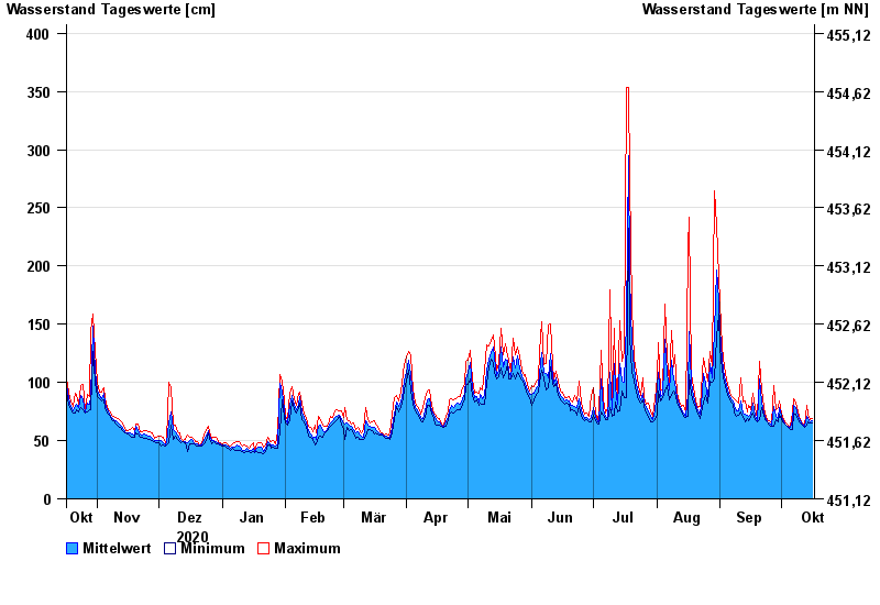
Chart of year Staufeneck / Saalach
Waterlevel from 17.10.2020 to 16.10.2021
- 14.09.1899 Wasserstand: 551 cm
- 05.07.1918 Wasserstand: 494 cm
- 07.09.1920 Wasserstand: 489 cm
- 07.08.1905 Wasserstand: 486 cm
- 31.07.1924 Wasserstand: 481 cm
| Date | Mean value [cm] | Maximum [cm] | Minimum [cm] |
|---|---|---|---|
| 16.10.2021 | 67 | 69 | 65 |
| 15.10.2021 | 66 | 68 | 65 |
| 14.10.2021 | 69 | 73 | 66 |
| 13.10.2021 | 71 | 80 | 63 |
| 12.10.2021 | 62 | 63 | 61 |
| 11.10.2021 | 64 | 65 | 63 |
| 10.10.2021 | 67 | 68 | 65 |
© Bayerisches Landesamt für Umwelt 2024