
- Start >
- Rivers >
- Waterlevel >
- Inn >
- Staufeneck >
- Chart of year

Chart of year Staufeneck / Saalach
Waterlevel from 09.12.2022 to 08.12.2023
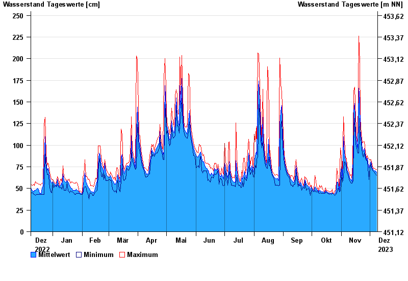
- Hochwassergefahrenfläche HQ100 490 cm
| Date | Mean value [cm] | Maximum [cm] | Minimum [cm] |
|---|---|---|---|
| 08.12.2023 | 68 | 72 | 65 |
| 07.12.2023 | 70 | 72 | 67 |
| 06.12.2023 | 70 | 73 | 68 |
| 05.12.2023 | 71 | 73 | 69 |
| 04.12.2023 | 72 | 73 | 70 |
| 03.12.2023 | 74 | 78 | 72 |
| 02.12.2023 | 81 | 83 | 78 |
© Bayerisches Landesamt für Umwelt 2024