
- Start >
- Rivers >
- Waterlevel >
- Inn >
- Stauden >
- Chart of year

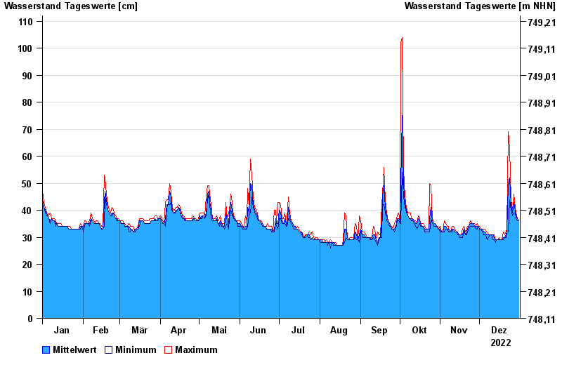
Chart of year Stauden / Leitzach
Waterlevel from 01.01.2022 to 31.12.2022
- 02.06.2013 Wasserstand: 191 cm
- 21.05.1999 Wasserstand: 190 cm
- 31.05.1940 Wasserstand: 172 cm
- 04.08.2020 Wasserstand: 165 cm
- 03.06.2010 Wasserstand: 164 cm
| Date | Mean value [cm] | Maximum [cm] | Minimum [cm] |
|---|---|---|---|
| 31.12.2022 | 36 | 36 | 36 |
| 30.12.2022 | 37 | 37 | 36 |
| 29.12.2022 | 38 | 39 | 37 |
| 28.12.2022 | 40 | 41 | 39 |
| 27.12.2022 | 43 | 46 | 39 |
| 26.12.2022 | 39 | 40 | 38 |
| 25.12.2022 | 42 | 44 | 40 |
© Bayerisches Landesamt für Umwelt 2024