
- Start >
- Rivers >
- Waterlevel >
- Inn >
- Stanggass >
- Chart of year

Chart of year Stanggass / Bischofswieser Ache
Waterlevel from 17.04.2024 to 16.04.2025
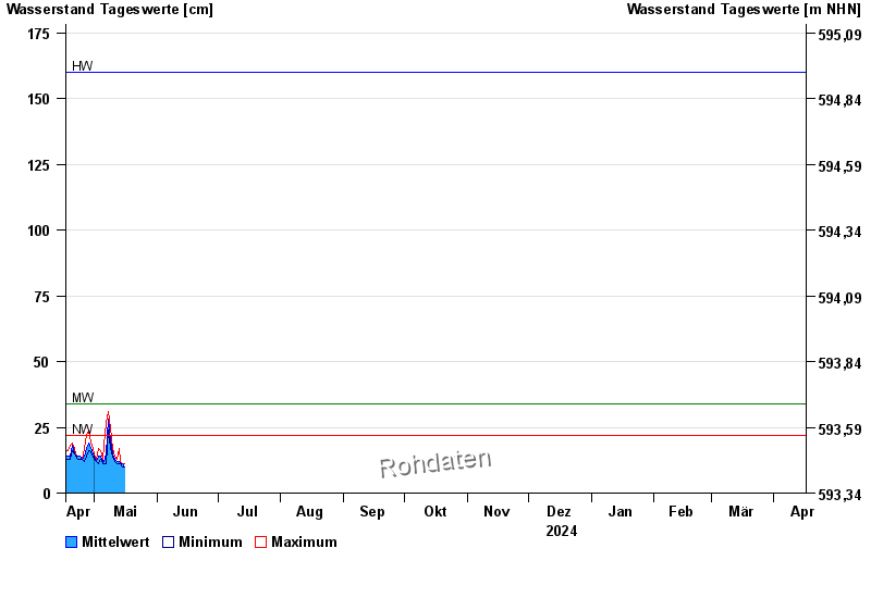
| Date | Mean value [cm] | Maximum [cm] | Minimum [cm] |
|---|---|---|---|
| 01.06.2024 | 19 | 19 | 19 |
| 31.05.2024 | 20 | 26 | 12 |
| 30.05.2024 | 12 | 16 | 9 |
| 29.05.2024 | 12 | 13 | 11 |
| 28.05.2024 | 13 | 20 | 10 |
| 27.05.2024 | 11 | 11 | 10 |
| 26.05.2024 | 12 | 13 | 11 |
© Bayerisches Landesamt für Umwelt 2024