
- Start >
- Rivers >
- Waterlevel >
- Inn >
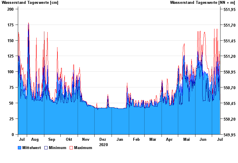
- Schwöbbrücke >
- Chart of year

Chart of year Schwöbbrücke / Königsseer Ache
Waterlevel from 16.07.2020 to 15.07.2021
- 01.08.1977 Wasserstand: 231 cm
- 12.07.2005 Wasserstand: 221 cm
- 17.07.2021 Wasserstand: 216 cm
- 13.08.2002 Wasserstand: 215 cm
- 31.07.2014 Wasserstand: 213 cm
| Date | Mean value [cm] | Maximum [cm] | Minimum [cm] |
|---|---|---|---|
| 15.07.2021 | 86 | 112 | 55 |
| 14.07.2021 | 117 | 133 | 95 |
| 13.07.2021 | 83 | 95 | 69 |
| 12.07.2021 | 93 | 94 | 92 |
| 11.07.2021 | 124 | 168 | 83 |
| 10.07.2021 | 87 | 88 | 81 |
| 09.07.2021 | 116 | 168 | 70 |
© Bayerisches Landesamt für Umwelt 2024